Frequently Asked Questions
Find answers to common questions about our land surveying services, processes, and documentation requirements.
General Questions
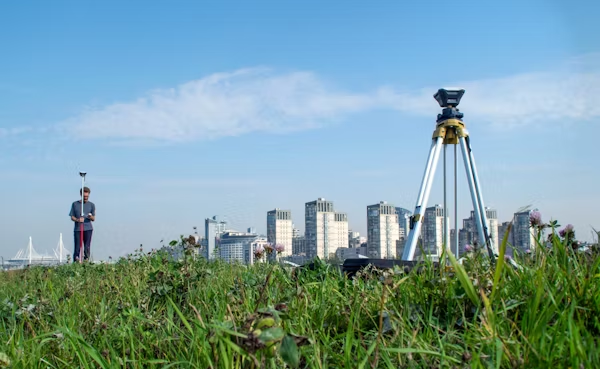
We provide end-to-end support for land and infrastructure projects, including DGPS and digital land surveys, boundary and topographic surveys, road and highway surveys, DTCP layouts, municipal and TS iPASS approvals, Vastu and working plans, building elevation designs, estimation & costing, property valuations, and home loan assistance.
We are headquartered in Mancherial, Telangana and deploy teams across the state for residential, commercial, agricultural, and infrastructure assignments. We also collaborate with partners for projects in neighboring states on request.
We support surveys, plans and application documentation for Municipal, Grampanchayat and TS iPASS projects. Requirements vary by project; contact us to confirm the required documents and professional credentials. Approval decisions rest with the relevant authorities.
Land Survey Services
Most boundary and demarcation surveys are completed within 3–7 days, depending on plot size, terrain, encroachments, and record availability. We confirm the exact schedule after a site assessment and document review.
Please share title documents (sale deed, pattadar passbook, 1B, Pahani), any existing survey sketches, site location details, and the purpose of the survey. We review these upfront and brief you on any additional requirements.
Our road and highway surveys cover alignment control, profiles and cross-sections, terrain and ROW mapping, utility inventories, and earthwork quantities. We issue CAD drawings, coordinate lists, quantity sheets, and supporting reports that integrate with DPR and construction teams.
Yes. Every survey includes both hard copy and digital deliverables such as CAD/DWG drawings, DXF files, GIS shapefiles, KML/KMZ, PDF reports, and coordinate spreadsheets so you can share data with architects, engineers, or authorities.
Approvals & Permissions
We prepare drawings, documentation, and application files required by Municipal and Grampanchayat offices, submit them on your behalf, and coordinate until approvals are issued. Our team tracks objections and provides revisions when needed.
We guide you through the TS iPASS application, compile survey data, compliance certificates, and layout drawings, and liaise with departments for inspections and clearances so your industrial project moves forward without delays.
Yes. We interact with municipal engineers, revenue officials, and TS iPASS officers, respond to queries, and attend site visits or joint measurements to ensure documentation is accepted on the first submission.
TS iPASS approval timelines vary based on project type and complexity. Typically, the process takes 15-30 days for standard projects, but we work to expedite the process through proper documentation and coordination with authorities.
Required documents include project proposal, land ownership documents, survey plans, building plans, environmental clearances, NOCs from various departments, and compliance certificates. We help prepare and organize all necessary documentation.
Design & Documentation Services
We deliver concept layouts aligned with Vastu principles, detailed working drawings (floor plans, elevations, sections), schedules, and sanction-ready documentation tailored to your plot dimensions and authority norms.
Yes. Our design team produces 2D and 3D elevation concepts, material palettes, and render-ready visuals that complement your architectural plans and reflect local approval guidelines.
Absolutely. We create registration plans, location sketches, and supporting documentation accepted by sub-registrar offices, revenue departments, and lending institutions for mutations, loan processing, and legal submissions.
Our team follows traditional Vastu Shastra principles including proper orientation, room placement, directional alignment, and energy flow considerations while maintaining modern functionality and approval compliance.
Yes, we create realistic 3D renderings and visualizations for building elevations, allowing you to see how your building will look before construction. This helps in material selection and design approval.
Absolutely. We offer design revisions based on your feedback or approval authority requirements. We work with you to refine the design until it meets your vision and approval standards.
Costs, Valuations & Financing
Pricing depends on survey type, area, accessibility, and deliverables. We share a transparent proposal after understanding your scope. Complex road or infrastructure surveys are quoted with phase-wise milestones.
Yes. Our engineers prepare detailed estimation and costing reports for construction projects, while our team supports property valuation reports for sale, purchase, banking, or legal needs.
We partner with leading banks and NBFCs to assist with housing loan documentation, technical reports, and valuations, ensuring your financing process is smooth and compliant.
Every project includes duly signed hard copies and comprehensive digital packages. You will receive PDFs, CAD files, coordinate spreadsheets, and photographs for your records and submissions.
Our cost estimation includes material costs, labor costs, equipment costs, overhead expenses, taxes, permits, and contingency allowances. We analyze market rates, project specifications, and site conditions to provide accurate estimates.
Our property valuations are based on comprehensive market analysis, comparable sales, property condition assessment, location factors, and current market trends. We follow industry standards to ensure accurate and reliable valuations.
Required documents include identity proof (Aadhaar, PAN), address proof, income documents (salary slips, IT returns), bank statements, property documents (sale deed, registration), and property valuation report. We help organize all necessary documentation.
Yes, we provide complete support throughout the home loan process including application preparation, documentation, lender coordination, follow-up on loan status, and assistance with any queries or additional requirements.
Project Logistics & Support
We recommend booking 5–7 days ahead for standard surveys and at least two weeks in advance for large infrastructure or approval projects so we can allocate the right team and equipment.
Yes. We regularly collaborate with architects, civil contractors, government engineers, and legal professionals to align survey outputs, permissions, and designs with broader project goals.
Our engagement continues even after delivery. We explain drawings, attend clarification meetings, update documentation if authorities request changes, and remain available for follow-up site visits.
Still Have Questions?
Can't find the answer you're looking for? Our team is here to help. Contact us today and we'll get back to you as soon as possible.